

Stagman Ridge to the Bumper and Horseshoe Meadow (Mt Adams)

Entry posted by Flutterbattyyy
2,951 views
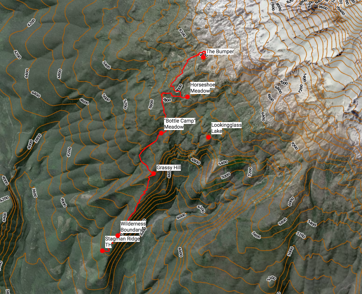
On July 26th, 2014, we hiked off-trail to the Bumper in the Mount Adams Wilderness and scrambled to the top. The Bumper is a prominent rocky knob on the west side of Mount Adams above the Pacific Crest Trail. The summit is 6,490 ft. high and offers superb views of Mount Adams craggy west face and its many hanging glaciers.
I have a new polarizer now, so this will be my first time trying it out. I already love it! ![]()
Opening image: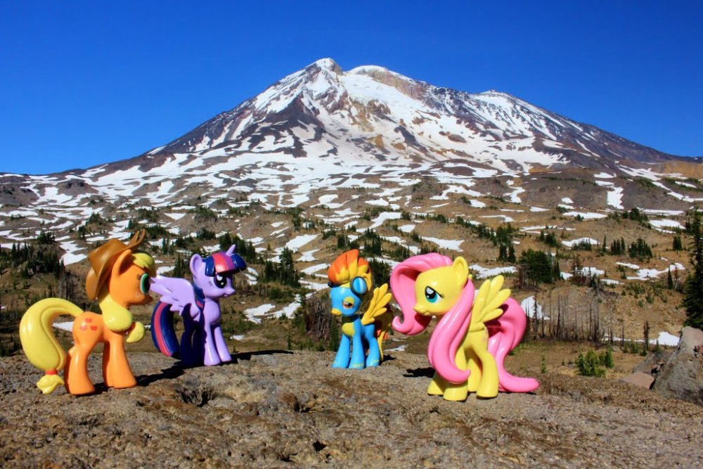
The ponies soaking in the views from the summit of the Bumper. 
A grammatical note about "The Bumper:"
It is called "The Bumper." Grammatically speaking, I am not entirely sure how it should be written as. "The" is part of the name of the peak, so it I think should(?) be capitalized, but then again, "the" isn't normally capitalized. My head hurts. XD 
––––Trip Report––––
We drove up Hwy 141 toward Mount Adams in southwest Washington's Volcano Country. The mountain loomed over the highway and Trout Lake valley, a truly impressive sight. Primary Forest Road 23 over Babyshoe Pass (4,334') has always been one of my favorite Cascade Range drives, the views, beautiful forests, and feeling of remoteness are some of its greatest qualities. We accidentally drove too far and missed the potholed Road 8031 turn. We reached the Mount Adams Viewpoint before realizing we went too far. We backtracked and found the road, and almost immediately crossed the bridge over the Wild and Scenic White Salmon River. The road wasn't too bad; we made it fine with our car. The only rough section was about half a mile long on FR 8031. Forest Road 070 and FR 120 were both very well-maintained and looked to be recently graveled.
We got to the trailhead by about 12:00 PM, much later than we hoped to be there. We started the hike on the Stagman Ridge Trail.
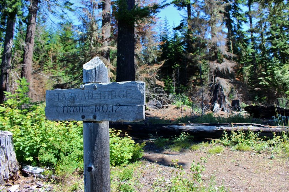
Stagman Ridge Trailhead Sign
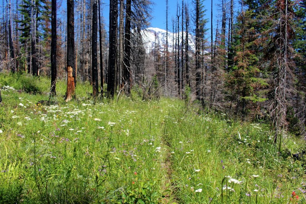
It starts out through the green forest for the first ~.7 miles and follows an old logging road for about .5 miles in. After leaving the logging road, the trail gets really brushy.
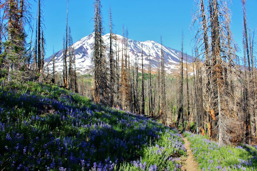
We soon entered the Mount Adams Wilderness and (sadly) the burnt forest from the 2012 Cascade Creek Fire. There were quite a few Tiger Lilies blooming along the first part of the trail and some more flowers that I don't know the name of. Along this trail, the meadows were thriving! The fire brought in more sunlight to the forest floor, making the wildflowers explode in growth. And along with the flowers, we spotted many butterflies. Through the first mile or so, the meadows have really overgrown the trail, 'till you can hardly see it. Mount Adams constantly was peeking over the trees along the wildflower-lined trail.
"Snowplowing" through the tall, grassy meadows. ![]()
As the trail descended the north slope of Grassy Hill, we entered a severely burned section of forest. But not too long after that we entered green forest again and crossed a small tributary of the White Salmon River. At the halfway point between Grassy Hill and the Graveyard Camp Cutoff Trail for Lookingglass Lake, we crossed a nice meadow with an impressive view of Mount Adams. At around this point, the lupines started to come out in full force. This is one of my favorite wildflowers.
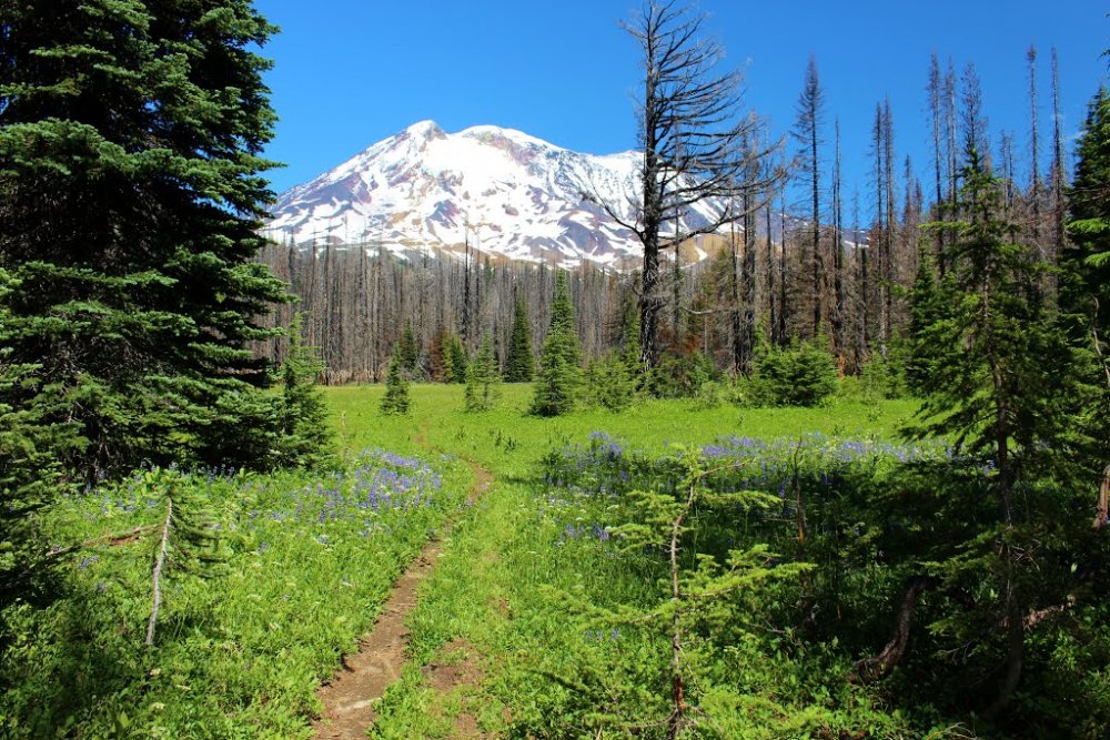
The nice meadow with an impressive view of Mount Adams.
We didn't go to Lookingglass Lake, but instead kept going towards Horseshoe Meadows and the Bumper. Mount Hood and St. Helens could be seen along much of the hike too. There were fields after fields of lupine along this trail!
When we got to the PCT, we turned north. The PCT traversed beautiful subalpine meadows and parklands as it skirted the west slope of Mt. Adams. We used our maps and GPS to find the right point on the PCT where we could venture off trail up to the Bumper. It's a wide meadow at a V-shaped corner on the PCT and the closest point the trail gets to the Bumper.
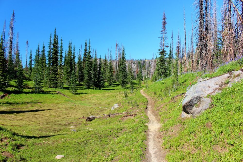
Green parklands along the Pacific Crest Trail.
Our GPS died just as we reached the spot to head off trail, but I figured I did enough route planning to be fine. All we had to do was head in the general direction of the Bumper, which was almost always in view. And Its pretty hard to get lost above the timberline, because the PCT, Round the Mountain, and Highline Trails go almost completely around the mountain anyway. Going off-trail to the Bumper is easy walking along the meadow for the most part of the journey.
We followed the paths of some ravines up to the left (north) side of the Bumper, bounded by a rocky cliff to the right (south) of our route up. From here, we could constantly look up to the Bumper's flat summit at 6,490 feet. We followed the ravines up to the left side of the Bumper, where we encountered the first snow along the hike. Views north included The Hump (6,608').
We then headed up to the north side of the Bumper, and started scrambling up the rocky talus slope.
Along the way up, we crossing a small snowfield.
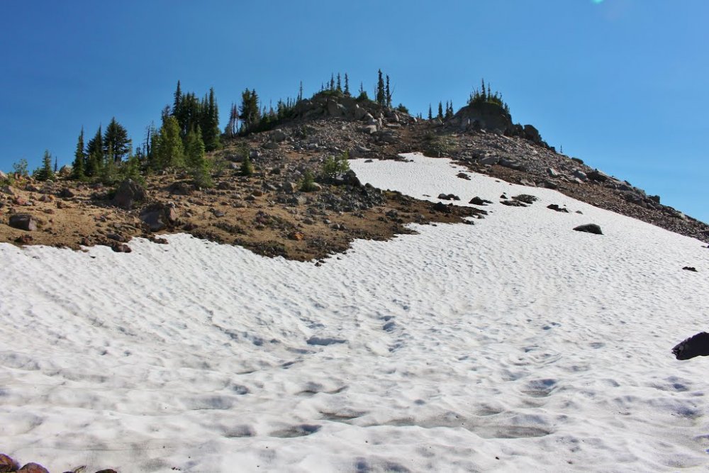
Ascending the north slope of the Bumper.
At the top, we were greeted by this jaw-dropping front row view of Mount Adams and the Pinnacle Glacier (left), the hanging White Salmon Glacier (upper middle), and the Avalanche Glacier (right), which caused a massive avalanche in 1997 that sent debris flowing most of the way down the Cascade Creek valley.
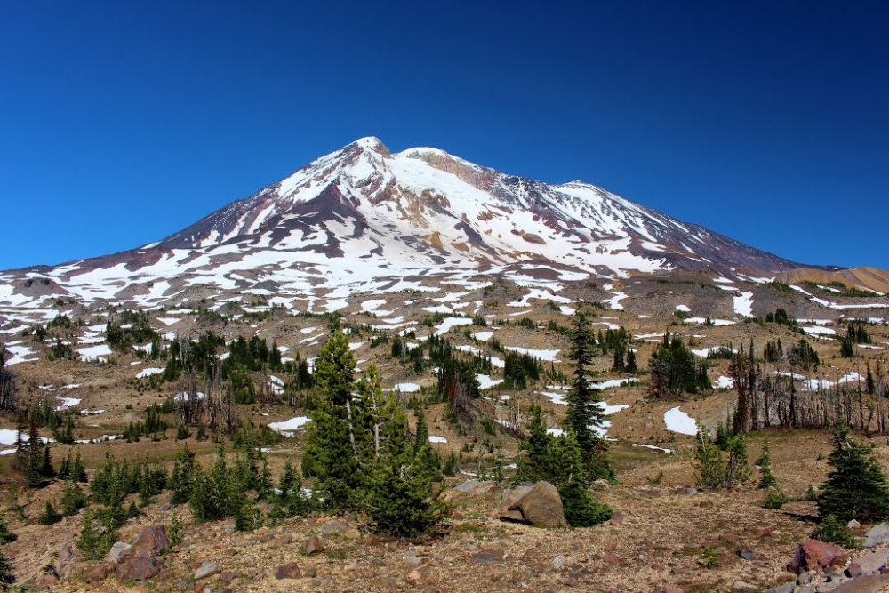
Mount Adams from the summit of the Bumper.
Also from the summit, we could see Mount St. Helens, the Lewis River watershed, and the rugged peaks of the Dark Divide. The top of the Bumper is a wide flat area, a good spot to pitch a tent I think.
After soaking up the views, we headed down the Bumper. We had no trouble finding our way down. We hiked back along the PCT towards Horseshoe Meadows.
Hiking back along the Round the Mountain Trail
At the junction with the Around the Mountain Trail, we hiked the short 0.1 mile to Horseshoe Meadow. Still very beautiful and enchanting even after the fire came through. There is a water source at the meadow, but from what I hear it runs dry late in the season. Mount Adams loomed above the meadow in all its snowy glory.
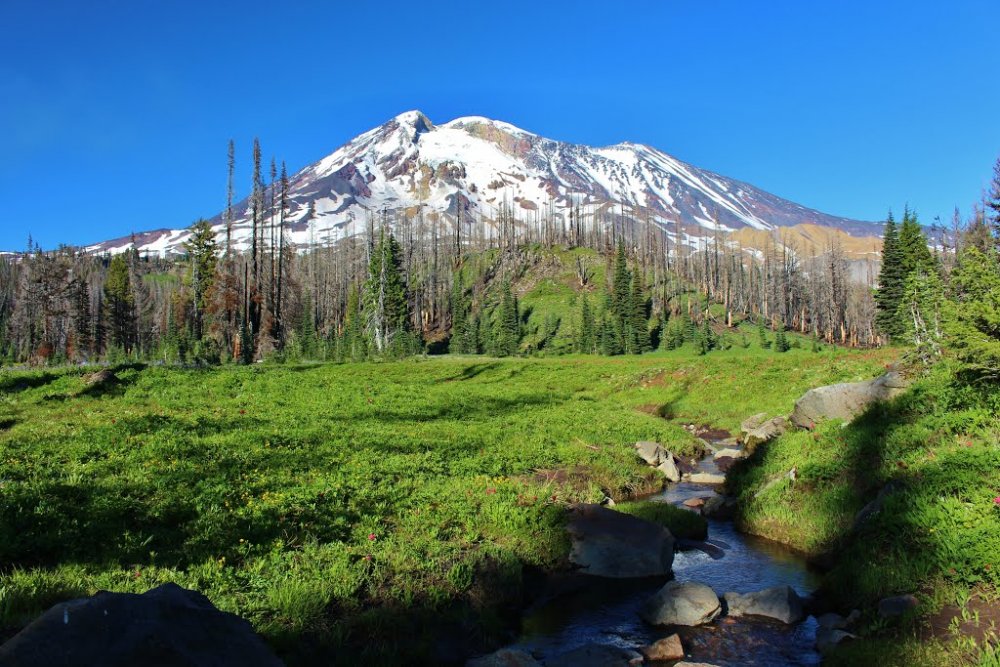
Horseshoe Meadow with a stream running through it.
After taking a few pics at Horseshoe Meadow, we headed down the PCT to meet up with the Stagman Ridge Trail junction. We arrived back at the trailhead just as the sun was setting on the horizon. There was some sunlight all the way back to Trout Lake.
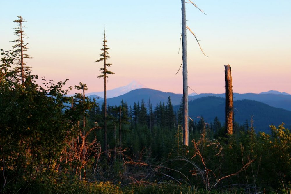
Sunset on Mount Hood from the trailhead.
0 Comments
Recommended Comments
There are no comments to display.
Create an account or sign in to comment
You need to be a member in order to leave a comment
Create an account
Sign up for a new account in our community. It's easy!
Join the herd!Sign in
Already have an account? Sign in here.
Sign In Now