Jump to content
Banner by ~ Ice Princess Silky

Flutterbattyyy

User
  • Posts

    319
  • Joined

  • Last visited

Blog Entries posted by Flutterbattyyy

  1. Flutterbattyyy
    Just started a Ponies Around the World Discord server! 
    Seeing as Equestria Daily's BIG PATW event is just around the corner, I figured it might be a neat idea to start a group for traveling, adventure, exploring, and Ponies Around the World.
     

    Join Here: https://discord.gg/asYTD4s 
     
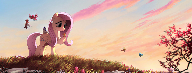
    Ponies Around the World is an event started by EQD where you bring your favorite pony toy, merch, etc. and take a photo of it at some significant landmark or place, whether it be famous or off-the-beaten track. Each year, hundreds of photos get submitted!
     
    The Idea:
    Share your "Ponies Around the World" images! Post your adventures! Give feedback, stay up to date, and get behind the scenes info on the "Equestria: Into the Wild" film Talk about hiking, traveling, and the outdoors  
     
    This group is an experiment, so I'll see how it pans out, lol.  It is affiliated with the Everfree Hikers facebook group.
  2. Flutterbattyyy
    In mid-August, we hiked the Bird Creek Meadows Loop from Bird Lake, with a small side-trip to Hellroaring Overlook. This was our second visit to the incredibly beautiful Mount Adams Recreation Area. On our last visit, we hiked up to Iceberg Lake via the Bird Creek Meadows Trailhead, along the way passing Hellroaring Overlook and 30+ mountain goats. See that trip report here.
     
    It was incredibly beautiful! We got to hike the loop in mid-August of 2015, just before the Cougar Creek Fire swept through the area this past summer. Much of Bird Creek Meadows was spared from the fire, but everything below Bluff Lake, including Bird Lake, was consumed by the fire.
     
    We hiked the loop clockwise, starting on the Bird Lake Trail and ending on the Bluff Lake Trail.


    Opening Photo:

    Small mountainside stream at Bird Creek Meadows
     
    Here is a video/short film I put together of this area, filmed during this hike and the previous hike up to Iceberg Lake in 2014.


    ------Trip Report------
     
    We started at the trailhead at Bird Lake Campground . This is Bird Lake before the fire.and headed up the Bird Lake Trail towards Crooked Creek Falls. The trail closely follows Crooked Creek, crossing it at times.


    The lush green shores of scenic Bird Lake


    The Bird Lake Trailhead.


    We soon came to a small waterfall along the Bird Lake Trail; the trail crosses over the creek just above the falls. The trail continued to meander through the lush, green forest and meadows, crossing the creek a few more times even.
     

    Crossing Crooked Creek


    Soon, we reached Crooked Creek Falls! This falls is around 50' tall, I believe. It is a gorgeous waterfall; one of my favorites on Mount Adams. We found lots of wildflowers along the creek too.
     

    Wildflowers consolidate around Crooked Creek Falls.


    Along the trail, we came to a neat little viewpoint. Right after soaking in the view at Crooked Creek Falls, we crossed a lovely mountain stream framed by more colorful wildflowers.
     

    Wildflowers along a mountain stream.


    Soon after the falls, we reached the junction with the Round the Mountain Trail. There were many small stream crossings along the Round the Mountain Trail, such as a small staircase waterfall.


    Small unnamed staircase waterfall along the Round the Mountain Trail.


    As sunset grew closer, the sky lit up! I loved hiking under this dramatic-looking sky. We then passed by a small pond along the Round the Mountain Trail. Most of the flowers were spent by now, but a few patches were left.


    The dramatic sky made the forest come alive with color.


    Soon we reached the junction with the Trail of Flowers; we turned left. We then took Trail #67 to the Hellroaring Canyon Overlook. Upon nearing the overlook, we came upon a nice patch of flowers in full bloom alongside a little stream.
     
    Wildflowers, oh my!
     

    Wildflowers congregate around a small, mountain spring.


    Soon Mount Adams and the massive Hellroaring Canyon unfolded before us. Mount Adams remained mostly hidden, but the dramatic clouds and epic canyon vista made up it.
    The ridge on the far right is the Ridge of Wonders, and the large waterfall at right-center is unofficially called Hellroaring Basin Falls. Little Mount Adams prominently marks the southeastern end of the Ridge of Wonders as well.


    The vista unfolds as one approaches Hellroaring Overlook.


    Little Mount Adams prominently marks the eastern end of the Ridge of Wonders.


    This is what the Hellroaring Overlook looks like on a clear, sunny day:

    Hellroaring Overlook. Photo taken in 2014.


    After Hellroaring Overlook, it was getting too dark for regular photos. On returning, we took the eastern half of the Trail of Flowers loop trail. Nearly all the picnic tables at the Bird Creek Meadows Picnic Area were half-buried in the ground.
     
    After passing through most of the half-buried picnic tables, we arrived at the Bird Creek Meadows sign. We then took the Bluff Lake Trail back to Bird Lake, but it was too dark to take any more photos. However, we did get one final view of Mount Adams. We also saw an unusable/retired water spigot that once served the picnic area.
     
    Along the Bluff Lake Trail, we crossed beneath Staircase Falls. As this falls lies below Bluff Lake, chances are it was consumed by the fire.


    Summary
    Distance: 5.67 mi
     
    Elevation SRTM
    Elevation Gain: 1149.88 ft
    Elevation Loss: 1149.88 ft
    Min Elevation: 5597.11 ft
    Max Elevation: 6502.62 ft
     
    ------Maps------
     
    Here is the topo map found on the Oregon Hikers Field Guide. Read the PH/OH hiking guide here

     
    GPSfly Track:
    http://gpsfly.org/g/5629


    ––––Everfree Hikers––––

     
    If you are a hiker (novice or experienced) or are interested in joining a brony hiking community, consider joining the group, Everfree Hikers. We have 126 members and counting!
    We welcome everyone of all levels of experience. While the group is focused on hiking, we also embrace mountain biking, climbing, rafting, birding, winter sports, and camping activities!
    We challenge everyone to be like Daring Do and go live your own adventure! #FindYourPark #WeAreTheWild #PoniesAroundTheWorld


    Source: Hiking the Incredibly Beautiful Bird Creek Meadows (Mt. Adams, Washington)
  3. Flutterbattyyy
    On July 26th, 2014, we hiked off-trail to the Bumper in the Mount Adams Wilderness and scrambled to the top. The Bumper is a prominent rocky knob on the west side of Mount Adams above the Pacific Crest Trail. The summit is 6,490 ft. high and offers superb views of Mount Adams craggy west face and its many hanging glaciers.
     
    I have a new polarizer now, so this will be my first time trying it out. I already love it!


    Opening image:

    The ponies soaking in the views from the summit of the Bumper.
     
    A grammatical note about "The Bumper:"


    ––––Trip Report––––
     
    We drove up Hwy 141 toward Mount Adams in southwest Washington's Volcano Country. The mountain loomed over the highway and Trout Lake valley, a truly impressive sight. Primary Forest Road 23 over Babyshoe Pass (4,334') has always been one of my favorite Cascade Range drives, the views, beautiful forests, and feeling of remoteness are some of its greatest qualities. We accidentally drove too far and missed the potholed Road 8031 turn. We reached the Mount Adams Viewpoint before realizing we went too far. We backtracked and found the road, and almost immediately crossed the bridge over the Wild and Scenic White Salmon River. The road wasn't too bad; we made it fine with our car. The only rough section was about half a mile long on FR 8031. Forest Road 070 and FR 120 were both very well-maintained and looked to be recently graveled.
     
    We got to the trailhead by about 12:00 PM, much later than we hoped to be there. We started the hike on the Stagman Ridge Trail.
     

    Stagman Ridge Trailhead Sign


    It starts out through the green forest for the first ~.7 miles and follows an old logging road for about .5 miles in. After leaving the logging road, the trail gets really brushy.


    We soon entered the Mount Adams Wilderness and (sadly) the burnt forest from the 2012 Cascade Creek Fire. There were quite a few Tiger Lilies blooming along the first part of the trail and some more flowers that I don't know the name of. Along this trail, the meadows were thriving! The fire brought in more sunlight to the forest floor, making the wildflowers explode in growth. And along with the flowers, we spotted many butterflies. Through the first mile or so, the meadows have really overgrown the trail, 'till you can hardly see it. Mount Adams constantly was peeking over the trees along the wildflower-lined trail.
     

    "Snowplowing" through the tall, grassy meadows.


    As the trail descended the north slope of Grassy Hill, we entered a severely burned section of forest. But not too long after that we entered green forest again and crossed a small tributary of the White Salmon River. At the halfway point between Grassy Hill and the Graveyard Camp Cutoff Trail for Lookingglass Lake, we crossed a nice meadow with an impressive view of Mount Adams. At around this point, the lupines started to come out in full force. This is one of my favorite wildflowers.
     

    The nice meadow with an impressive view of Mount Adams.


    We didn't go to Lookingglass Lake, but instead kept going towards Horseshoe Meadows and the Bumper. Mount Hood and St. Helens could be seen along much of the hike too. There were fields after fields of lupine along this trail!
     
    When we got to the PCT, we turned north. The PCT traversed beautiful subalpine meadows and parklands as it skirted the west slope of Mt. Adams. We used our maps and GPS to find the right point on the PCT where we could venture off trail up to the Bumper. It's a wide meadow at a V-shaped corner on the PCT and the closest point the trail gets to the Bumper.
     

    Green parklands along the Pacific Crest Trail.


    Our GPS died just as we reached the spot to head off trail, but I figured I did enough route planning to be fine. All we had to do was head in the general direction of the Bumper, which was almost always in view. And Its pretty hard to get lost above the timberline, because the PCT, Round the Mountain, and Highline Trails go almost completely around the mountain anyway. Going off-trail to the Bumper is easy walking along the meadow for the most part of the journey.
     
    We followed the paths of some ravines up to the left (north) side of the Bumper, bounded by a rocky cliff to the right (south) of our route up. From here, we could constantly look up to the Bumper's flat summit at 6,490 feet. We followed the ravines up to the left side of the Bumper, where we encountered the first snow along the hike. Views north included The Hump (6,608').
     
    We then headed up to the north side of the Bumper, and started scrambling up the rocky talus slope.
    Along the way up, we crossing a small snowfield.
     

    Ascending the north slope of the Bumper.


    At the top, we were greeted by this jaw-dropping front row view of Mount Adams and the Pinnacle Glacier (left), the hanging White Salmon Glacier (upper middle), and the Avalanche Glacier (right), which caused a massive avalanche in 1997 that sent debris flowing most of the way down the Cascade Creek valley.
     

    Mount Adams from the summit of the Bumper.


    Also from the summit, we could see Mount St. Helens, the Lewis River watershed, and the rugged peaks of the Dark Divide. The top of the Bumper is a wide flat area, a good spot to pitch a tent I think.
     
    After soaking up the views, we headed down the Bumper. We had no trouble finding our way down. We hiked back along the PCT towards Horseshoe Meadows.
     

    Hiking back along the Round the Mountain Trail


    At the junction with the Around the Mountain Trail, we hiked the short 0.1 mile to Horseshoe Meadow. Still very beautiful and enchanting even after the fire came through. There is a water source at the meadow, but from what I hear it runs dry late in the season. Mount Adams loomed above the meadow in all its snowy glory.
     

    Horseshoe Meadow with a stream running through it.


    After taking a few pics at Horseshoe Meadow, we headed down the PCT to meet up with the Stagman Ridge Trail junction. We arrived back at the trailhead just as the sun was setting on the horizon. There was some sunlight all the way back to Trout Lake.
     

    Sunset on Mount Hood from the trailhead.


    ––––Hike Stats––––  
    Summary  
     
    Distance: 12.22 mi  


    Elevation Gain: 2391.65 ft  
    Elevation Loss: 2401.49 ft  
     
    Min Elevation: 4222.44 ft  
     
    Max Elevation: 6459.97 ft  


    Link to downloadable GPS Track
    Alternate GPS Track (CalTopo)
  4. Flutterbattyyy
    "Another day, another dungeon!" –Daring Do.
    I have had a lifetime passion for the outdoors, hiking, and the mountains. That led me to create the "Pony Northwest: Ponies Around the World" video (a.k.a. 'Massive 2-year Pony Hiking Project,' as called by EQD). Later on, I organized the online brony hikers community, Everfree Hikers.
     
    Combining my love for My Little Pony and hiking can be tricky (being seemingly unrelated subjects), but I found that bringing and taking photos of the ponies along on my hikes helps to connect them together nicely.


    Map of all my hikes in my lifetime.

    2015: Purple 2014: Green 2013: Gold 2012: Red 2011: Blue Pre-2011: Pink


    Here are just a couple of the photos I've taken on my hikes and travels. I have hiked in Washington, Oregon, British Columbia, Alberta, California, and, (soon to be this summer), Idaho. I can't wait to get back from college to go hiking!


    Garibaldi Lake; Garibaldi Provincial Park, British Columbia, Canada.


    Three Sisters from McKenzie Pass; Willamette National Forest, Oregon.


    Bird Creek Meadows; Mount Adams Recreation Area, Washington.


    Mountain Goats on Burroughs Mountain; Mount Rainier National Park, Washington.


    North Sister from South Mattieu Lake; Three Sisters Wilderness, Oregon.


    Purple Trillium on Little Huckleberry Mountain; Gifford Pinchot National Forest, Washington.


    Mount Adams from Sunrise Shortcut Trail; Dark Divide Roadless Area, Washington.
    (Read about the current threats to the Dark Divide here.)


    The Adams Glacier tumbles off of Mount Adams' northwest face; High Camp, Mount Adams Wilderness, Washington.


    The Painted Hills; John Day Fossil Beds National Monument, Oregon.


    Dry Creek Road; Gifford Pinchot National Forest, Washington.


    Between the summers of 2014 and mid-July of 2015, I created a little video featuring nearly all of the places I've brought the ponies along. This summer I hope to film a timelapse video featuring the ponies in beautiful landscapes for EQD's annual Ponies Around the World event.


    I love sharing these adventures with people, especially helping others find new and exciting adventures. I love helping provide recommendations for good hikes–especially those around Mount Adams, the Gifford Pinchot National Forest, and the greater Washington state area.


    Mount Adams Reflection from Takhlakh Lake; Gifford Pinchot National Forest, Washington.


    Daring Do at Moraine Lake; Banff National Park, Alberta, Canada.


    The Mighty Robson Glacier; Mount Robson Provincial Park, British Columbia, Canada.


    Newberry Caldera, Paulina Lake, and East Lake from Paulina Peak; Newberry National Volcanic Monument, Oregon.


    Emperor Falls along the Berg Lake Trail in the Canadian Rockies; Mount Robson Provincial Park, British Columbia, Canada.


    Mount Robson from the Berg Lake Trail in the Canadian Rockies; Mount Robson Provincial Park, British Columbia, Canada.


    Mount Jefferson from Triangulation Peak; Willamette National Forest, Oregon.


    The Mount St. Helens National Volcanic Monument, Gifford Pinchot National Forest, Washington.


    Mount Adams Recreation Area, Washington.


    Hellroaring Overlook and Mount Adams; Mount Adams Recreation Area, Washington.


    Columbine on Little Huckleberry Mountain Trail; Gifford Pinchot National Forest, Washington.


    Iceberg Lake and the Mazama Glacier on Mount Adams; Mount Adams Recreation Area, Washington.


    Cascade Pass; North Cascades National Park, Washington.


    Mount Adams from Muddy Meadows; Gifford Pinchot National Forest, Washington.


    Lower Falls of the Lewis River; Gifford Pinchot National Forest, Washington.


    Paulina Lake from Paulina Peak; Newberry National Volcanic Monument, Oregon.


    Tatoosh Range from Panorama Point; Mount Rainier National Park, Washington.


    Mount Adams from the Goat Rocks; Goat Rocks Wilderness, Washington.


    Mount Adams from the Highline Trail; Mount Adams Wilderness, Washington.


    Crater Lake National Park, Oregon.


    And finally the prettiest element of nature, Fluttershy.
     

    Art by Alasou.
  5. Flutterbattyyy
    From Thursday, June 16th to Saturday, June 18th, we backpacked into the Ancient Lakes in eastern Washington's Channeled Scablands region and made a 2-night basecamp to explore the area further.
     
    We drove in from Oregon hoping to experience a little bit of what eastern Washington has to offer. It was beyond breathtaking!


    Day 1:
    We hiked in from the lower trailhead up to Ancient Lakes to camp for two nights. We wanted to take the north cliffside trail, but decided to take the "main" trail into the lakes for the first day instead. Wildflowers lined this trail. We hiked in about two hours before sunset; the colors on the sage-covered fields and rocky cliffsides came alive with color! We didn't see anybody along the hike either, so we had plenty of solitude! We camped at the far end of Ancient Lakes at the second campsite below the back cliff. We were the only ones there that night too. The mosquitos were bad, so be warned! Not as bad as some places I've been, but still an annoyance. But the beauty more than makes up for it.
     

    It was about a five hour drive to the trailhead from Portland, Oregon. We got to the trailhead around 6:30 PM, two and a half hours before sunset.


    The view of the Ancient Lakes as viewed during sunset (taken at 1.9 miles in).


    More wildflowers! These particular ones were seen all along the first day's hike.
    View a 360° Photo Sphere from this spot.


    Rugged cliffs lit up by the sunset.


    Day 2:
     
    On the second day, a few campers came in to camp below us. We went on a day hike up onto the south cliffside and to a vantage point overlooking Dusty Lake. The trail was easy to follow, wildflower-strewn (tons of flowers!), easy to hike, all except for the last tiny section descending the canyon wall. It was steep and slippery, covered in loose scree, fine dust, and talus. Nothing too tricky, but can be a bit slippery. After getting to the bottom, it was a gentle coasting up and down over grassy, wildflower-covered hills back to camp.


    Round-headed Buckweat carpeting the slopes above the Ancient Lakes.
    View a 360° Photo Sphere from this viewpoint!


    This hike featured many different types of wildflowers.


    Panorama taken from the Dusty Lake Viewpoint.


    Another image to possibly be submitted to Equestria Daily's "Ponies Around the World" event.


    Looking back at the way we came.


    Once we got back to camp, it started to cloud over. Around 10 P.M., it started to rain—lightly at first, gentle though heavy by the next morning.


    The waterfall across the lake from our tent. Now that I look closer, I can kind of see a faint trail climbing up the left side of the falls.


    Day 3:
     
    On the third day, we hiked out in the rain via the "shortcut" trail, which hugs the north cliff-face (the same trail we wanted to hike in by). It was a wildflower-strewn hike, but the brushy and narrow path meant our pants and shoes got soaked very quickly (not an issue since we were wearing quick-drying synthetics/running shoes, however ). It passed right below a seasonal waterfall and a large boulder/erratic.


    Hiking out in the rain along the cliff-side trail.


    While yes, there is farmland surrounding the Ancient Lakes coulee basin, we couldn't really see them from our campsite at the lakes. It feels as if they aren't really there! As if it were sage-covered desert for miles and miles! Along the hike through and above the cliff-faces, you can see more of the farms, but they aren't really a distraction/detraction to the "wilderness" experience, in my opinion. You will be gawking at the amazing views that the Ancient Lakes have to offer.
     
    There are also tons (and tons) of campsites, so I guess either this area must get super crowded/full on some weekends, or there's just a lot of space to spread around and choose your site. Most sites seem to be pretty flat and have large fire rings (I guess people bring in their wood?). Some sites even have stone benches to sit on.
     
    This is a super easy backpacking trip or day hike, so even families with children could make it. Highly recommended!


    Photo Sphere Virtual Hike: I took a total of 16 photo spheres! You can view the photo spheres here to take a "virtual hike." They are linked together in the same style as Google Maps Street View.
  6. Flutterbattyyy
    So now that the summer of 2017 is in full swing, I have been hard at work getting to various places with my ponies. I also recently got a Flutterbat plush to take with me, so I'm excited for that! 
     
    But first, a few from last year.

    Just like the photo of Crystal Lake in the original post, this was taken from our campsite at Crystal Lake. The view is of Mount Adams' west face. The Daring Do engraved compass was bought at Everfree NW last year.


    This was taken from our campsite at Crystal Lake as well, but this time looking north towards Mount Rainier and the Goat Rocks. The view was spectacular!


    For my last hike of the summer, I made the long 6 hour drive up to Mount Baker and Artist Point to hike the Ptarmigan Ridge Trail. Here is Rainbow Dash in front of Mount Shuksan. Mount Baker is directly opposite of Shuksan (so behind me as I was taking this photo).


    May, 2017:

    For my very first hike of the year, I headed out to Columbia Hills State Park in eastern Washington, just north of the Oregon border along the Columbia River Gorge.
    We did a 7 mile loop hike, finishing off on the Vista Loop Trail. Here is Flutterbat enjoying the fields upon fields of yellow Western Basalmroot and purple Lupine characteristic of the eastern Columbia River Gorge. In the near distance is the mighty Columbia River, the largest river on the west coast.


    For the second hike of the year, I ventured up the Herman Creek Trail for around 5 miles (10 miles round trip). At the turnaround point for the day, I photographed Rarity among the lush green forests characteristic of northern Oregon and the Columbia River Gorge.


    For the last hike in may, Fluttershy and I hiked the Dry Creek Trail in southern Washington near the Trapper Creek Wilderness. Here she is enjoying the relaxing sound of the babbling creek. The trail is relatively flat as it follows the gentle uphill grade of the creek.


    To finish off, here is a photo of my newest custom Flutterbat plush (made by LanaCraft) with my larger Fluttershy plush. I'll be taking the smaller one hiking with me for the rest of this summer.

  7. Flutterbattyyy
    Camping at the Sixteen Canyon trestle crossing


    During the end of May, we backpacked along the Deschutes River Canyon via the Macks Canyon Trailhead.
    We hiked the southern end of the Deschutes River Trail, which is a rugged and rough trail following an old, abandoned railroad grade from around the 1910s (historical information on the Deschutes River railroad war). Many of the original rail ties can still be seen lying along the grade. The trail navigates around old trestle bridge locations, as the trestles no longer exist. Going in and out of them can be a bit challenging.
     
    We camped on the edge of the trestle embankment on the edge of Sixteen Canyon. The view was amazing. I loved the site.


    GPS track and map of our hike to Sixteen Canyon:


    The trail departing from the Macks Canyon Trailhead:

    (Photo Sphere)


    Crossing Macks Canyon:


    Once on the other side of Macks Canyon, we regained the railroad grade:


    The trail seems to split here. We took the low route (the high route is up on that left-hand ridgeline):


    This section here had lots of rockfall, but was fairly easy to navigate. The trail is easy to follow the entire way to Sixteen Canyon.

    (Photo Sphere)


    We reached the first set of rail ties and followed it for a while:

    (Photo Sphere)


    (Photo Sphere)


    We crossed a few smaller trestle canyons, such as this one here. Going up these canyons weren't all that difficult.

    (Photo Sphere)


    About a mile in, the terrain switched to rolling, grassy hills.

    (Photo Sphere)


    (Another Photo Sphere 1,000 feet further)


    We reached Sixteen Canyon, our intended camp destination.
     
    (Photo Sphere)


    Looking out over Sixteen Canyon:


    We pitched our tents on the extended embankment. The wind was incredibly strong in the afternoon while we were setting up the tents; our campsite was very exposed, situated between two canyons which funneled down air in two directions. We had to weigh them down them with lots of large rocks. The wind died down by nightfall.


    My Tarptent Double Rainbow tent (it faired really well in the strong wind we had that afternoon)


    Looking back the way we came:


    Sunrise the next day.

    I created a timelapse of the sunrise.
    https://www.youtube.com/watch?v=kaorc_fXqco


×
×
  • Create New...